
8th ISAG (18)
![]()
8th International Symposium on
Andean Geodynamics (ISAG)
UPDATE! - Programme
You can download the up-to-date programme here.
The +6000 km-long Andean Cordillera represents a unique natural laboratory for studying the geological and geodynamical process associated with the construction and development of a continental mountain range. A decade after the last ISAG in Nice, we have decided to revive this unique symposium on Andean geology and geodynamics but also its related economical and social issues. Because these topics are of major importance for Andean countries, the 8th International Symposium on Andean Geodynamics (ISAG) will be held in Quito, Ecuador on September 24-26th, 2019.
The next ISAG is being organized by the Instituto Geofísico, Escuela Politécnica Nacional (IG-EPN) of Quito (Ecuador) and the French Institut de Recherche pour le Développement (IRD), and will be held on the Hotel Mercure Alameda Quito, the official hotel for the ISAG.
We expect that ~250 earth scientists will attend the conference. Given the number of submitted abstracts and the current level of registrations, we are confident that this symposium will be an exciting forum for scientific exchange between Earth scientists from South America, Europe, and North America.
Conference languages
For both, oral and poster sessions, the preferred language is English, although Spanish or French are also accepted. However, there will be no facilities for simultaneous translation.
Registration
In order to attend the 8th ISAG you should register as soon as possible by filling the following form: Registration Form.
Field trips
The organizing committee is planning some field trips in the region. All the information is in this page.
Correspondence and enquiries
Please send a message to Esta dirección de correo electrónico está siendo protegida contra los robots de spam. Necesita tener JavaScript habilitado para poder verlo. or contact the local organizers.
With the academic and financial support of:
 |
||
 |
 |
 |
With the financial support of:
 |
||
 |
 |
|
 |
 |
|
 |
 |
|
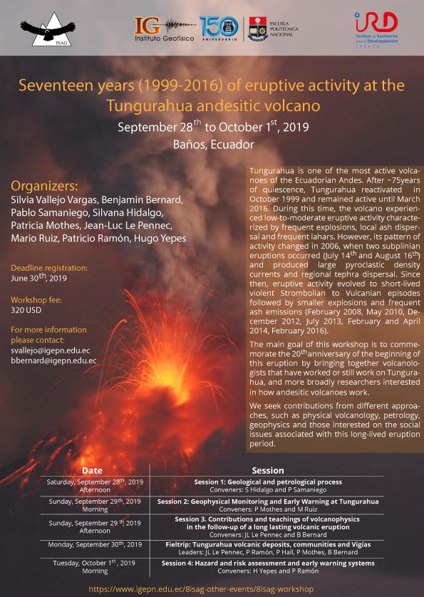
Seventeen years (1999-2016) of eruptive activity at the Tungurahua andesitic volcano
Organizers:
Silvia Vallejo Vargas1, Benjamin Bernard1
Pablo Samaniego2, Silvana Hidalgo1, Patricia Mothes1, Jean-Luc Le Pennec2, Mario Ruiz1, Patricio Ramon1, Hugo Yepes1
1 IG-EPN, 2 IRD
September 28th to October 1st, 2019
Tungurahua volcano is one of the most active volcanoes of the Ecuadorian Andes. After ~75 years of quiescence, Tungurahua reactivated in October 1999 and remained active until March 2016. During this time, the volcano experienced low-to-moderate eruptive activity characterized by frequent explosions, local ash dispersal and frequent lahars. However, its pattern of activity changed in 2006, when one subplinian eruption occurred (August 16th) and produced large pyroclastic density currents and regional tephra dispersal. Since then, eruptive activity evolved to short-lived violent Strombolian to Vulcanian episodes followed by smaller explosions and frequent ash emissions (February 2008, May 2010, December 2012, July 2013, February and April 2014, February 2016).
The main goal of this workshop is to commemorate the 20th anniversary of the beginning of this eruption by bringing together volcanologists that have worked or still work on Tungurahua, and more broadly researchers interested in how andesitic volcanoes work.
We seek contributions from different approaches, such as physical volcanology, petrology, geophysics and those interested on the social issues associated with this long-lived eruption period.
UPDATE: You can access the full programme from this location.
|
Date |
Session |
|
Saturday, September 28th, 2019 Afternoon |
Session 1: Geological and petrological process |
|
Sunday, September 29th, 2019 Morning |
Session 2: Geophysical Monitoring and Early Warning at Tungurahua |
|
Sunday, September 29th, 2019 Afternoon |
Session 3: Contributions and teachings of volcano-physics in the follow-up of a long-lasting volcanic eruption |
|
Monday, September 30th |
Fieldtrip: Tungurahua monitoring system and volcanic deposits |
|
Tuesday, October 1st, 2019 Morning |
Session 4: Hazard and risk assessment |
For information about this event please contact:
Esta dirección de correo electrónico está siendo protegida contra los robots de spam. Necesita tener JavaScript habilitado para poder verlo., Esta dirección de correo electrónico está siendo protegida contra los robots de spam. Necesita tener JavaScript habilitado para poder verlo.
SESSIONS
Session 1: Geological and petrological process
Conveners: Silvana Hidalgo and Pablo Samaniego
(Saturday, September 28th, 2019. Afternoon)
Tungurahua volcano is an archetypical andesitic stratovolcano located in the Eastern Cordillera of the Ecuadorian arc. It is one of the most active Ecuadorian volcanoes with at least 4 eruptive episodes during historical times (i.e. since the beginning of the Spanish conquest). These eruptions include the 1641, 1773, 1889 and 1916-1918 events. In 1999, just before the Tungurahua reawakening, Hall et al. (1999) published their pioneering work on the eruptive chronology of Tungurahua volcano. Based on this work, Tungurahua was constructed by 3 successive edifices, the younger being the Tungurahua III that was formed during the last 3000 years, after a large sector collapse. During the last two decades, a series of in-depth studies was devoted to improve several aspects of the geological and petrological evolution of this volcano. Among the most important advances, we should mention: (1) a new geochronological dataset that allows to better constraint the main eruptive stages of this volcano and to estimate its eruptive and erosion rates; (2) the efforts to propose a new, high-frequency eruptive chronology for the last 3000 years BP; (3) the new geochemical and petrological data for the last 3 millennia, that allow us to identify the pre-eruptive magmatic process active at Tungurahua.
Session 2: Geophysical Monitoring and Early Warning at Tungurahua
Conveners: Patricia Mothes and Mario Ruiz
(Sunday, September 29th, 2019. Morning)
Tungurahua volcano in its nearly 20 years of on-off eruptive activity that began in 1999 produced a huge suite of seismic, infrasound, deformation, laharic and gas signals, and as well an important dataset of visual and infrared images. Since 2006, this volcano has a permanent and modern network of broad band seismic and infrasound stations. Real time data streams were used to forecast possible strengthening or decline of volcanic activity. Temporal deployments of geophysical instruments have also contributed to enhance our understanding of volcanic activity. Strong correlations also exist between patterns seen in the geophysical data and surface activity (ash falls and gravitational flows) of the volcano. In this session we invite those who have worked on Tungurahua geophysical data to present the results and perspectives of their investigations. We would also like to explore other avenues of investigation to be made with the existing data bank that could be exploited through collaborative research.
Session 3: Contributions and teachings of volcano-physics in the follow-up of a long-lasting volcanic eruption
Conveners: Jean-Luc Le Pennec and Benjamin Bernard
(Sunday, September 29th, 2019. Afternoon)
This session aims to present the main results from volcano-physical studies of the Tungurahua 1999-2016 eruption from the ground up. In order to define the volcanic activity, it is critical to obtain qualitative and quantitative data on the eruptive processes. These data are mostly obtained after detailed field work using up-dated acquisition and processing methods. Tungurahua 1999-2016 eruption exhibited almost every volcanic phenomenon including gas and pyroclastic plumes, pyroclastic fallouts and density currents, lava flows and lahars. The study of those phenomena and their deposits allowed to extract eruption source parameters and test numerical models. Based on the results obtained and their comparison with geophysical monitoring data we would like to open a discussion about the eruptive dynamics at Tungurahua that would be useful for long-term hazard assessment and short-term crisis management. This session is also the opportunity to focus on the debated characterization of Strombolian, violent Strombolian, Vulcanian and sub-Plinian eruptive styles at Tungurahua and other andesitic volcanoes worldwide.
Session 4: Hazard and risk assessment and early warning systems
Conveners: Hugo Yepes and Patricio Ramón
(Tuesday, October 1st, 2019. Morning)
Once the eruptive period in the Tungurahua began in 1999, hazard assessment was aided by a hazard map prepared in 1988 (Hall et al) which was used to discuss with the authorities and the community on the preparedness plans and mitigation activities. With the new information that was acquired afterwards by the IG researchers, this map was reissued in 2002. Later on, with the experience of what happened during the great eruptions in 2006, a new hazard map of Tungurahua was prepared in 2008, accounting for the effects of these eruptions and that map has been used for hazard mitigation up to the present. The first ash falls that occurred with the initial explosive activity of the volcano gave rise to the generation of the first lahars. The IG installed lahars detectors in the Juive and Vazcún ravines, where they most frequently occurred; this way, a first system of early warning for lahars was initiated, with the participation of authorities, vigías and the community. This was the base for the definitive implementation of the Early Warning System that worked successfully in the following years and until the end of the eruption. We will have different presentations that will discuss how the evaluation of the threat of the volcano was carried out and the experiences on the implementation and application of the Tungurahua Early Warning System.
FieldTrips
Leaders: JLL, PR, PH, PM, BB
(Monday, September 30th)
- First stop, El Salado hotspring: spring water and lahar monitoring, lahar and PDC deposits, effects of the eruption (2005-2008 lahar, 2006 PDC), exposure to volcanic hazards (hotspring, hotels, technical school of Baños, main road)
- Second stop, Los Pájaros: eruptive history (Cantera Las Juntas, lava flows), 2006 PDC deposits, effects of the eruption (Juive Grande)
- Third stop, Achupashal ravine: past and present activity (lahars, dense and dilute PDCs)
- Fourth stop, Palitahua: effects of the 2006 eruption (victims, houses and bridge), vigías of Tungurahua (Jorge Totoy), fallout monitoring system
- Fifth stop, Penipe: Permanent shelters
Each main stop will be ~1h-1h30.
Workshop Fee: 320 USD
The fee includes:
- transportation Quito-Baños-Quito
- 3 nights at Sangay Hotel (Baños) in double rooms
- 3 breakfasts and 3 lunchs at the hotel
- 4 coffebreaks
- boxlunch for the fieldtrip
Our online registration is closed!
If you want to attend the meeting, please send an email to Esta dirección de correo electrónico está siendo protegida contra los robots de spam. Necesita tener JavaScript habilitado para poder verlo..
Scientific Programme
As usual for this conference, we are planning a “plenary session” during the morning of the three days of the symposium, whereas the afternoon will be devoted to oral presentations in two simultaneous “thematic sessions”. The poster's presentations will take place at the end of each day. In addition, four 45-min-long Keynote talks are scheduled and covers different aspect of the Andean geology. The organizing committee kindly thank Ms. S. Mahlburg Kay, and M. P. Molnar, V.A. Ramos and E. Calais for accepting to give a keynote talk during the next ISAG.
We kindly ask you to check the ISAG webpage (www.igepn.edu.ec/8isag) in order to access the full programme and other additional information.
We also invite you to check the accepted abstracts at the following link: www.igepn.edu.ec/8isag-abstracts
We received more than 250 abstracts for the 8th ISAG. The organizing committee distributed the oral and poster presentations based in the author’s preference as well as in the abstract’s contents. The accepted abstract concern most aspects of Andean geodynamics. Some editing was performed by the Organising Committee, however, we would underline the fact that authors are responsible for the quality of their abstract. The final distribution has been revised and accepted by the ISAG scientific advisory board. Final instructions and updates will be e-mailed to registered participants a few weeks before beginning of the symposium and posted on the ISAG webpage (www.igepn.edu.ec/8isag).
Plenary session
The Organizing committee choose a group of abstract to be presented as oral communications during the morning’s Plenary talks. These abstracts were selected following different criteria such as their broad implications on Andean geodynamics, as well as trying to respect a regional equilibrium.
Thematic Sessions
Based on the received abstract, the organizing committee organize them in several thematic sessions that include:
(1) Andean structure imaged by geophysical studies
(2) Tectonics and Basins
(3) Andean magmatism
(4) Active tectonics and deformation
(5) Seismology
(6) Andean volcanism.
Oral and poster presentations
Talks will last 12 minutes each and will be followed by 3 minutes of discussion. For oral and poster sessions, the preferred language is English, although Spanish is also accepted. However, there will be no facilities for simultaneous translation. We request that your presentation will be uploaded in two formats (pptx and pdf) the previous day of the talk. The organizing committee will install a technical desk close to the conference rooms.
In order to prepare the final program and avoid the potential “no-shows”, we kindly ask that the authors to check the tentative program, and report to us in the case that you cannot attend the meeting.
There will be a poster session each day (from 17h00 until 18h30). Posters will remain on display all day long. Maximum dimensions for posters are 80 cm in width (horizontal) and 110 cm in height (vertical). Poster orientation is portrait. Each poster will be numbered (please see the final programme) and must be hung at its corresponding place at 8:30 in the morning of the day planned for it.
Registration
Registration for the ISAG Symposium will be in the lobby of the official Conference Hotel Mercure. Registration schedule will be the following:
- Sept. 23rd: 13:00-18:00
- Sept. 24th: 08:00-13:00
All participants must register and collect their ISAG ID to participate in the symposium.
Note that the late bird registration fee is 230 USD, excepting for students (100 USD). Registration fees include the conference registration and materials, the ice-breaker welcoming cocktail on September 23th, six coffee breaks, and the conference closing cocktail on September 26th. The ice-breaker welcoming cocktail will be take place at the conference Hotel at 18:00.
Registration fees do not include regular meals, lodging, or transportation.
You can access the Registration Form by clicking here.
Cancellation and refunds
Given that we are less than 1 month from the symposium, no refunds will be made.
If you sent a written notification of cancellation to the local Organizing Committee (Esta dirección de correo electrónico está siendo protegida contra los robots de spam. Necesita tener JavaScript habilitado para poder verlo.), refunds will be processed after the conference. Remember, an administrative charge (30% per participant) will be deducted from the cancelled amount.
Special grants
The IG-EPN and IRD are pleased to inform that an important number of special grants were preferentially allocated to scientists and students from South America and will include registration fees and lodging (in double room) at the conference hotel (Hotel Mercure Alameda Quito). Recipients of these Special Grants were communicated in the previous weeks.
Air transportation to Quito
Your airport Transfer IN to symposium Hotel Mercure is included. If you would like to take advantage of the free airport transfer to the Hotel, please send us your complete flight information (Airline and Flight number, arrival and departure info) as soon as you can.
Airport transfer will only be provided to those who send their flight information and only between the nights of the 22nd and until the morning of the 24th of September.
Look for the sign “ISAG 8th Symposium Ecuador”
We require this information by September 10th. Send your flight information to Esta dirección de correo electrónico está siendo protegida contra los robots de spam. Necesita tener JavaScript habilitado para poder verlo.. Resend just to be sure your flight information was received.
In the case you have any flight delays or flight cancellations, please let us know by Email or Whatsapp/Text to +593 999 800 438 so we can coordinate a new pick up time for you.
Hotel accommodation
Given that the official hotel is fully booked, we are not accepting additional reservations. Participants are invited to contact the organizing committee (Esta dirección de correo electrónico está siendo protegida contra los robots de spam. Necesita tener JavaScript habilitado para poder verlo.) which may provide other interesting options.
Social events
An Ice-breaker will take place on September 23th and a Conference closing cocktail on September 26th. The costs are included in the registration fees. To attend, please mark these options when registering on the webpage.
Setting and Weather conditions
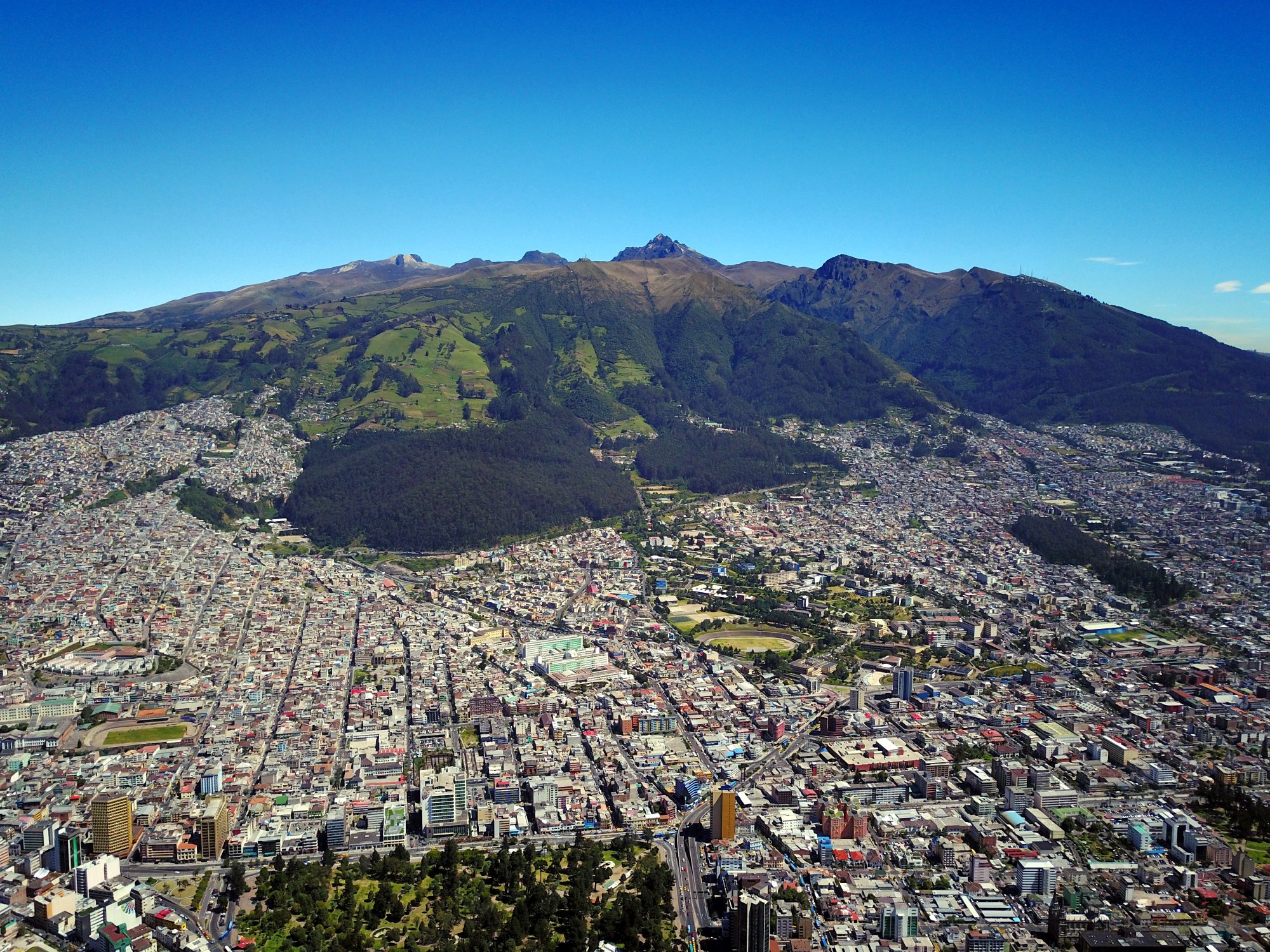
Quito, located on the Ecuadorian Andes at 2800 meters in elevation, is blessed with a spring-like climate most of the year. September is usually sunny, but afternoon thunderstorms can happen. Daytime temperatures of 20-25ºC, and 10-20ºC during the night are expected. Participant should be aware with the high altitude of the Quito. Travellers to the Amazon basin or the Pacific coastal area are might be surprised by the warm, but not hot daytime temperatures (25-35ºC), thanks to the frequent cloud cover. It is recommended that everyone bring a rain/wind breaker for daily use, especially for those thinking to attend the fieldtrips.
Currency
The local currency in Ecuador is the US dollar. Many exchange houses exist in Quito and credit cards are accepted in ATM.
Transportation from the Airport
Participants with reservations at the proposed hotel (Hotel Mercure Alameda Quito) will benefit of free transportation from the airport (September 22th and 23th). Please contact the organizing committee until September 10th (Esta dirección de correo electrónico está siendo protegida contra los robots de spam. Necesita tener JavaScript habilitado para poder verlo.) in order to arrange this service. Otherwise, there are numerous taxis available at the airport. Quito facilities and most hotels sit roughly 45 minutes away from the airport (one way main rate of 25-30 USD).
Insurance
All medical attention in Ecuador is on a cash basis. You are encouraged to come to Ecuador with adequate insurance coverage. Participants who will be attending certain field trips should be aware of the high elevations that might be reached, and should take the necessary precautions.

The geology of the Ecuadorian Eastern Cordillera
Leaders: R.A. Spikings (U. Genève), B. Beate (DG-EPN)
Dates: September 20th to 23th, 2019
Departure: September 20th at 07:00.
Field Trip nights included: September 20th, 21th & 22th
Notes: Night of September 19th is included at the Mercure hotel (shared basis)
If you are interested in participate in this fieldtrip, please contact our logistical team at Esta dirección de correo electrónico está siendo protegida contra los robots de spam. Necesita tener JavaScript habilitado para poder verlo.
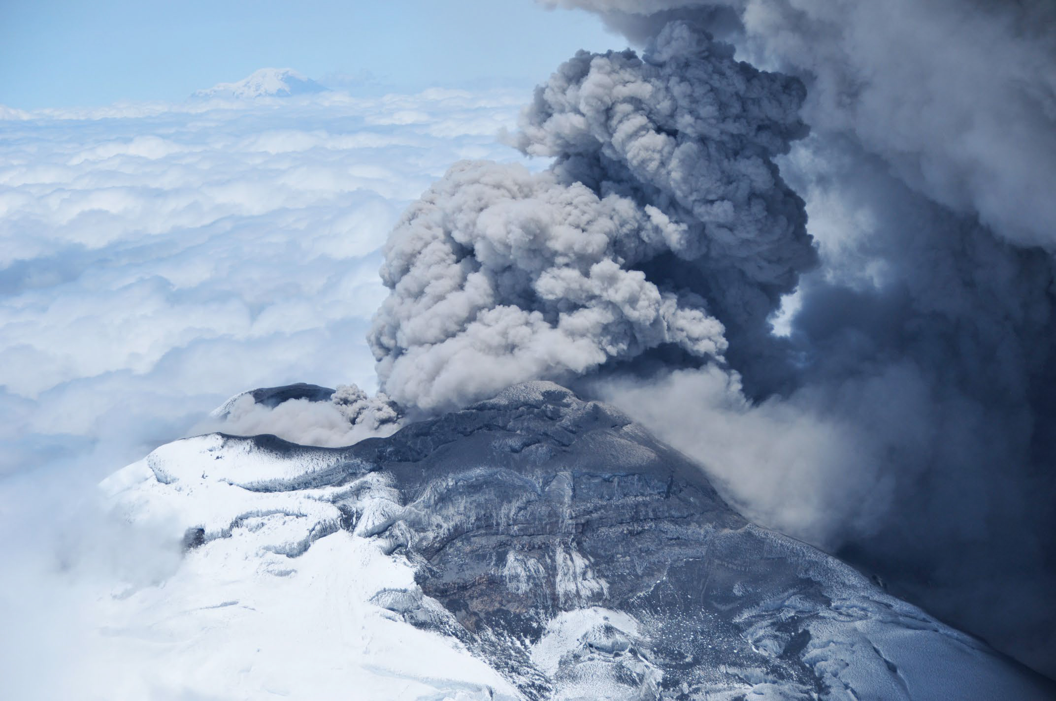
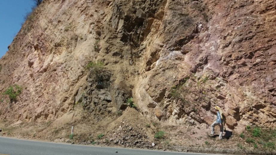
The Eastern Cordillera of Ecuador is an Andean trending magmatic and metamorphic belt that exposes rocks spanning from the Palaeozoic basement to the modern active arc, and records the early disassembly of Pangaea in the Triassic, subsequent prolonged Jurassic - Early Cretaceous active margin magmatism during hyper-extension, and the collision and accretion of the Caribbean Large Igneous Province in the late Cretaceous. The field trip plans to make the following stops: (1) Ammonite bearing quartzites and slates of the Chaucha Block, which is considered to be para-autochthonous continental crust that rifted from South America during Early Cretaceous hyper-extension (stop close to the town of Alausi); (2) The Peltetec sequence, which is a tectonic melange that hosts ultra-mafic and mafic lithologies, which range in age from Neoproterozoic to Early Cretaceous, and is considered to have formed during the closure of an Early Cretaceous basin that was floored by a transitional mafic crust; (3) Tungurahua Volcano, which is part of the modern arc and has been continually erupting since 1999 until the mid-2016; (4) A west-to-east traverse across the Cordillera, where we will cross Triassic anatectites that formed during a rift-to-drift transition, and Jurassic-Early Cretaceous arc rocks that formed in a prevailing extensional setting.

Cotopaxi Volcano: rhyolites to andesites from 0.5 Ma to the present
Leaders: P. Mothes and M.L. Hall (IGEPN)
Dates: September 21th and 22th, 2019
Departure: September 21th at 08:00.
Field Trip nights included: September 21th
Notes: Nights of September 20th and 22th are included at the Mercure hotel (shared basis)
If you are interested in participate in this fieldtrip, please contact our logistical team at Esta dirección de correo electrónico está siendo protegida contra los robots de spam. Necesita tener JavaScript habilitado para poder verlo.
Cotopaxi volcano is one of the most active and iconic stratovolcanoes of the Ecuadorian Andes. Its history covers more than 0.5 Ma and includes the rhyolitic explosive deposits of its Pleistocene volcanic history, including the (~200 ka, 100 km3 ) Chalupas ignimbrite. During this fieldtrip, we will also observe the eruptive products of the last 7000 ka, that includes rhyolitic tephra fallout and pyroclastic flow deposits, debris avalanche and lahar deposits, and the historical scoria flows and debris flows deposits.
Major active faults and historic earthquake surface ruptures in Central Ecuador
Leaders: S. Baize (IRSN), L. Audin (IRD), A. Alvarado (IG-EPN) and H. Jomard (IRSN)
Dates: September 20th to 23th, 2019
Departure: September 20th at 07:30.
Field Trip nights included: September 20th, 21th & 22th
Notes: Night of Sept. 19 is included at the Mercure hotel (shared basis)
If you are interested in participate in this fieldtrip, please contact our logistical team at Esta dirección de correo electrónico está siendo protegida contra los robots de spam. Necesita tener JavaScript habilitado para poder verlo.
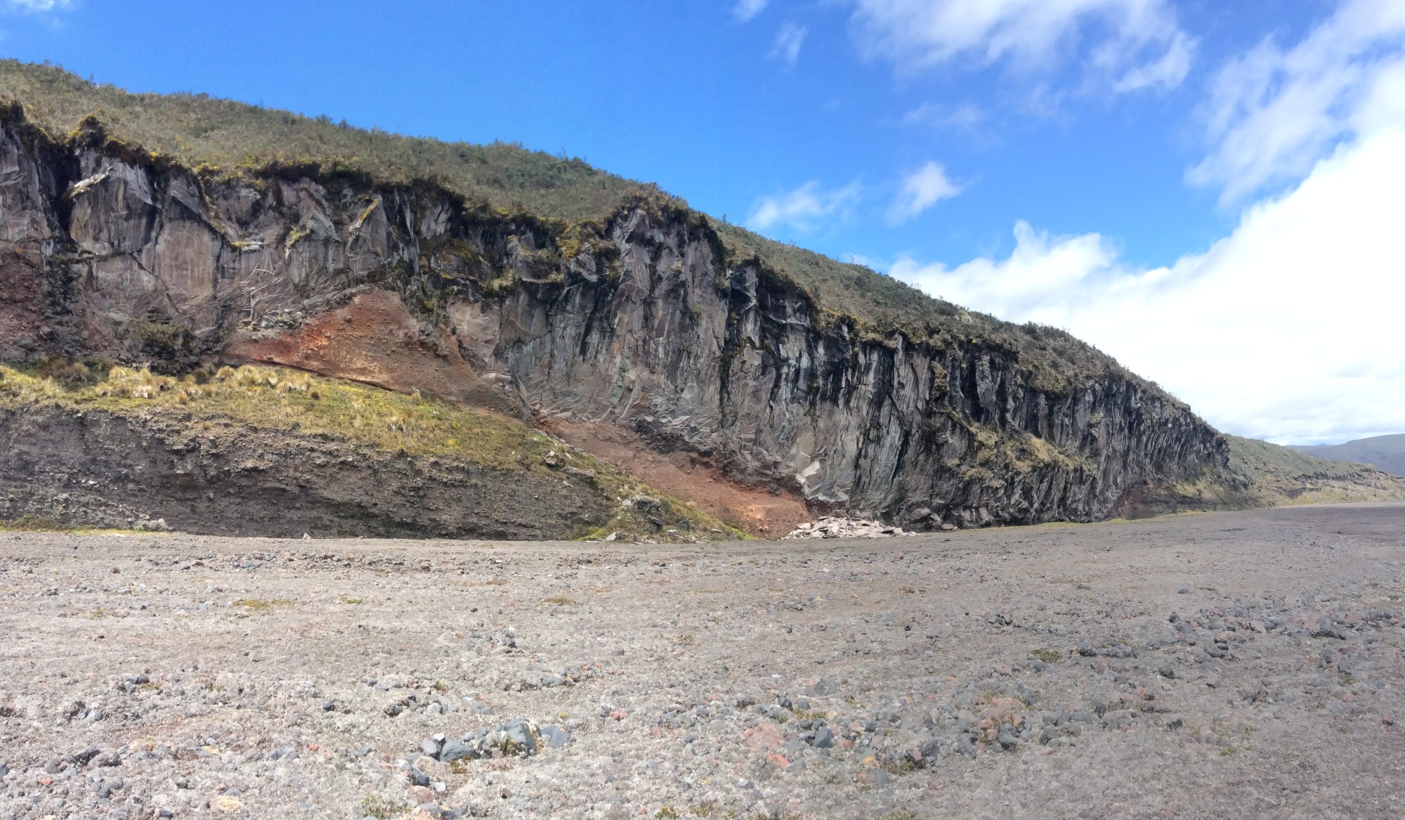
The Chingual-Cosanga-Pallatanga-Puna fault system is a major tectonic feature of the northern Andes, which accommodates the relative displacement (8 mm/a) between the North Andean Sliver and the South America Plate (Alvarado et al., 2016). The fault system imprints are strikingly similar to those of other major continental fault zones in the world. It includes a series of parallel or branching active fault strands, which historical activity is suggested by major and damaging earthquakes since at least the 17th century (Yepes et al., 2016).
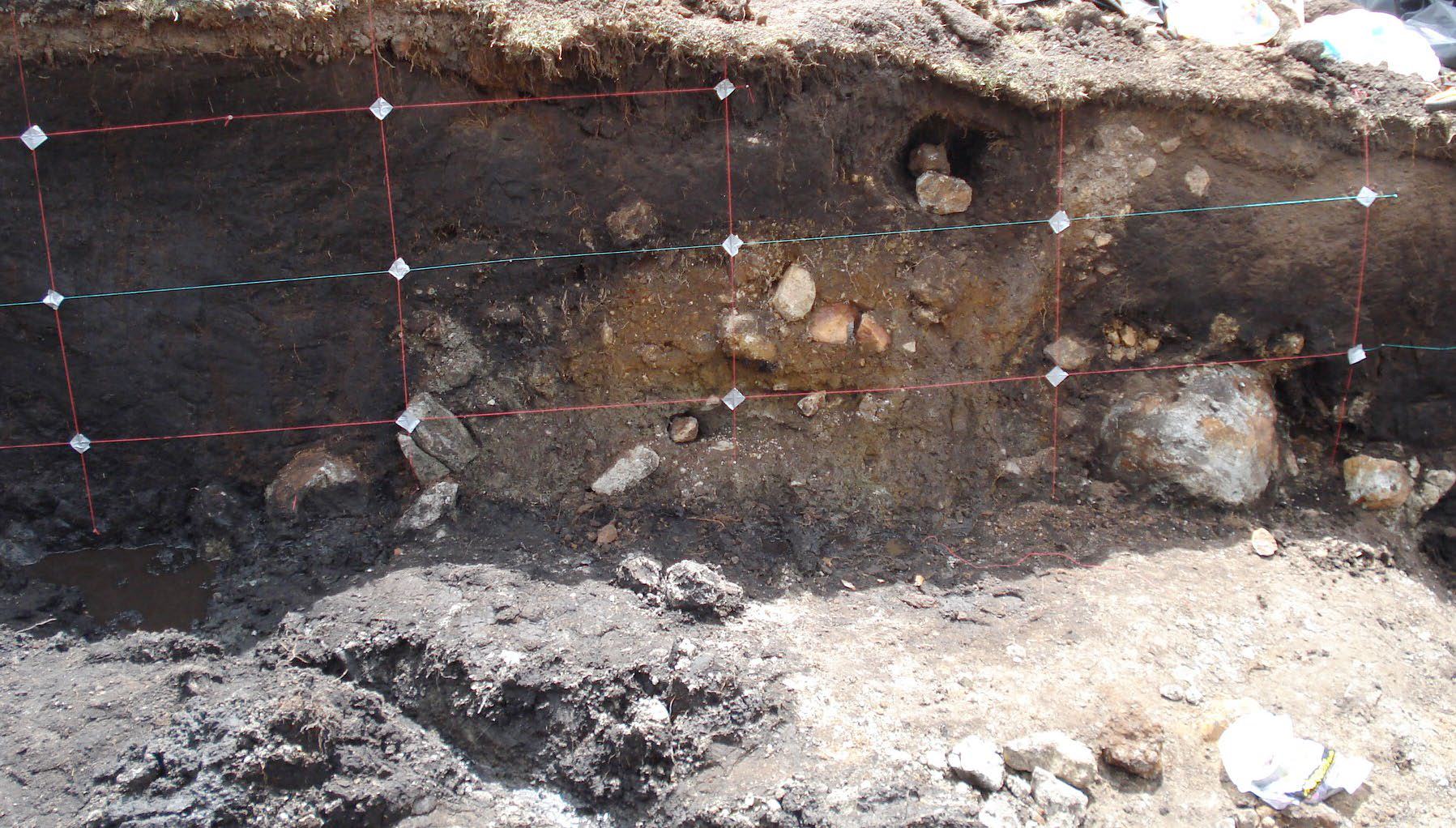
During this 4-days field trip, we plan to present, among other short stops, the most prominent geomorphological and geological evidences of fault activity along this system, including surface ruptures associated with moderate and large magnitude earthquakes. We will have a look at Quito fault zone (Alvarado et al., 2014), then drive to the south in order to get an overview of recently studied active faults. We will have a look at the Pallatanga fault in Rumipamba where the first trenches in Ecuador were performed to find back the source of 1797 M7.5+ Riobamba earthquake (Baize et al; 2015) and drive uphill to the Pisayambo Laguna area where a M5 earthquake ruptured the fault system up to the surface (Champenois et al., 2017). We will also make a detour to the Igualata volcano summit (4500m) to observe a surface rupture, which is probably associated with the major Riobamba earthquake (Baize et al., in prep).
Field Trips
Different groups working in Ecuador proposed several pre-symposium fieldtrips. The logistics of these fieldtrips is being assured by our local logistics team following the requests from each field-trip leader. We should stress that the scientific part of these fieldtrips is also under the responsibility of the fieldtrip leaders.
The cost of each field trip includes bus and/or air transport, lodging in double occupancy rooms, breakfast, box-lunch, and field guides. These prices do not include dinners. All taxes are included. Given that there are logistic limitations, the number of participants will be restricted.
Field trips will start from the official Hotel Mercure. Please be ready to go 20 minutes before departure time.
Note: Participants are advised that we will be at high elevations, up to 4500 m above sea level (asl). Please be sure that your health is compatible with being at these altitudes. Above 3000 m asl, temperatures will generally be between 5 – 20°C; driving rain and strong winds are possible. Sunscreen, hats, and adequate clothing are necessities. Water and lunch will be provided in the field. The organizing committee will not be responsible for any accidents that might occur during the trip. Participants are recommended to have their own health and travel insurance.
Más...
Peter Molnar
Professor of geological sciences at University of Colorado, Boulder
His research focuses on how mountain ranges form and by studying the deformation of the continental lithosphere.
He was awarded by the prestigious Crafoord prize in 2014 "for his ground-breaking contribution to the understanding of global tectonics, in particular the deformation of continents and the structure and evolution of mountain ranges, as well as the impact of tectonic processes on ocean-atmosphere circulation and climate".
https://www.colorado.edu/geologicalsciences/peter-molnar

Suzanne M. Kay
Professor of geological sciences at Cornell University
Her research focuses on the applications of petrology and geochemistry to the origin and evolution of the continental crust, with particular emphasis on the relation of regional tectonics to magmatic processes at the Andean context.
She was recently awarded by distinguished career award from the Mineralogy, Geochemistry, Petrology, Volcanology division of the Geological Society of America.
https://www.eas.cornell.edu/faculty-directory/suzanne-mahlburg-kay

Víctor A. Ramos
Emeritus Professor at Universidad de Buenos Aires
His research focus on the tectonic evolution of South America. In 2017, he was awarded by the TWAS-Lenovo Science Prize “for his contributions to the understanding of the formation of the Andes and the crustal evolution of South America”.
http://www.idean.gl.fcen.uba.ar//wp-content/cvs/andina_cv_ramos_v.pdf
Eric Calais
Professor of Geosciences at Ecole Normale Superieure in Paris, member of the French National Academy of Sciences, and Senior Fellow of the Institut Universitaire de France.
His research interests concern the kinematics and dynamics of active tectonic processes, using as a main tool space geodesy, in particular the Global Positioning System (GPS), and the mechanical modelling of lithospheric deformation. He has also been involved in applied seismic hazard studies.
http://www.geologie.ens.fr/~ecalais/
Scientific Themes
We especially encourage contributions addressing the following topics:
(1) Mechanisms and processes of crustal thickening, uplift and deformation
(2) Modern and ancient volcanism and magmatism
(3) Interactions between climate, surface and lithospheric processes
(4) The seismic cycle and active deformation
(5) Sedimentary basins and petroleum geology
(6) Andean geological resources, mineral deposits and geothermal resources
(7) Geological hazard and risk, with emphasis on seismic, volcanic, and gravitational phe nomena
Abstracts
Each participant will be allowed one oral contribution as first author. Communications must be written in English and should be 1 page-long, including text and references. Abstracts should be submitted before May 15th 2019. In order to submit an Abstract, you should register to the conference by filling the corresponding Registration Form, and then you will receive a confirmation email with a link for submit your Abstract(s). If you wish to submit more than one Abstract, please use the same provided link.
Oral and poster presentations
Talks will last 12 minutes each, and will be followed by 3 minutes of discussion. For oral and poster sessions, the preferred language is English, although Spanish is also accepted. However, there will be no facilities for simultaneous translation. There will be a poster session each day (from 16h30 until 18h00). Posters will remain on display all day long. Maximum dimensions for posters are 80 cm in width (horizontal) and 110 cm in height (vertical).
Cretaceous Geology and Metallogeny of Southern Ecuador
Leaders: O. Poma (Cornerstone Ecuador S.A.), Arturo Egüez (DG-EPN)
Dates: September 27th to 30th, 2019 (*)
(*) Due to flight’s reservations, we need people to sign up for this fieldtrip before June 3rd.
NOTE: If you want to participate in this fieldtrip and in a pre-conference field trip, please contact the organizing commitee.
Approx. cost: $660
Minimum number of participants: 15
Maximum number of participants: 20
The cretaceous Alamor-Lancones basin is located into the Huacabamba deflection, a geographic region which represents the transition between Central to Northern Andes, where the Cordillera change from NW to NE trend. The basin is limited by Triassic metamorphic blocks, the Amotape-Tahuin to the northwest and the Loja Terrane to the Southeast.
The Alamor-Lancones basin can be divided into a northwestern quartz-rich domain and a southeastern volcaniclastic domain (Jaillard et al, 1999). The earliest volcanism accompanying rifting is dominated by basaltic pillow lavas and breccias with related VMS deposits formed between 104 to 100 Ma. A second phase of felsic-rich volcanism with ages of 99 to 91 Ma intercalated and overlain by siliciclastic and carbonate sedimentary sequences in northwestern section of the basin (Winter, 2008), at this time the Bramaderos porphyry was deposited (Schutte, 2010) and possible related epithermal vein systems at its borders.
The aim of the field trip is go through the basin from the northwest area in the contact between metamorphic rocks and overlain sedimentary western domain toward the southeastern domain where dominated volcanism with porphyry and epithermal deposits are present on the upper sequences and ending in the lower basaltic sequences.
El ISAG es un congreso que abarca todos los ámbitos de la geodinámica andina. Este congreso cuenta con la participación de investigadores, profesionales y estudiantes, con ponencias de alto nivel. Al ser un congreso internacional, los participantes vienen no sólo de América Latina, sino del mundo entero. Este congreso es una excelente oportunidad para presentar a su empresa. Nuestros Auspiciantes obtienen los beneficios para la presencia de su empresa, especialmente diseñados para esta edición.
Existen las siguientes categorías de auspicio:
ORO (US $5000)
- PRESENCIA DE MARCA
La empresa puede ubicar un banner de la empresa en la sala de conferencia. - PIEZAS GRÁFICAS
Logotipo de su empresa en conjunto por categoría en: programa de mano, plano de sede, gigantografía, folletos, roll screen. - PRESENCIA EN SITIO WEB
Logotipo haciendo link a la web de su empresa. - PRESENCIA EN REDES SOCIALES y BOLETINES ELECTRÓNICOS
A través de Facebook y correo masivo. - OTROS BENEFICIOS
Derecho a la instalación de un stand permanente en ubicación preferencial durante todo el congreso.
Instalación de material promocional de su empresa en el Maletín del participante al congreso (1 unidad).
10 inscripciones full pass al congreso.
PLATA (US $3000)
- PRESENCIA DE MARCA
La empresa puede ubicar un banner de la empresa en la sala de conferencia. - PIEZAS GRÁFICAS
Logotipo de su empresa en conjunto por categoría en: programa de mano, plano de sede, gigantografía, folletos, roll screen. - PRESENCIA EN SITIO WEB
Logotipo haciendo link a la web de su empresa. - PRESENCIA EN REDES SOCIALES y BOLETINES ELECTRÓNICOS
A través de Facebook y correo masivo. - OTROS BENEFICIOS
Derecho a la instalación de un stand permanente durante todo el congreso.
Inclusión de material promocional de su empresa en el Maletín del participante al congreso (1 unidad).
6 inscripciones full pass al congreso.
BRONCE (US $1000)
- PIEZAS GRÁFICAS
Logotipo de su empresa en conjunto por categoría en: programa de mano, plano de sede, gigantografía , folletos, roll screen. - PRESENCIA EN SITIO WEB
Logotipo haciendo link a la web de su empresa. - PRESENCIA EN REDES SOCIALES y BOLETINES ELECTRÓNICOS
A través de Facebook y correo masivo. - OTROS BENEFICIOS
Derecho a la instalación de un stand permanente durante todo el congreso.
Inclusión de material promocional de su empresa en el Maletín del participante al congreso (1 unidad).
2 inscripciones full pass al congreso.
OTROS
- COCKTAIL DE BIENVENIDA o COCKTAIL DE CLAUSURA (500 USD)
La empresa puede ubicar su roll up en la sala del cocktail.
La empresa puede distribuir material pubicitario al ingreso al evento.
Logotipo de su empresa en boletín electrónico, programa de mano, gigantografía, roll screen y en el sitio web del evento, haciendo link a la web de su empresa.
1 inscripción full pass al congreso.
Para obtenter mayor información, contactarse con la dirección Esta dirección de correo electrónico está siendo protegida contra los robots de spam. Necesita tener JavaScript habilitado para poder verlo..
- Está aquí:
-
Inicio

-
Publicaciones
-
Desarrollo
- Noticias
© 2026 Instituto Geofísico - EPN

Inicio | Escuela Politécnica Nacional | Correo Institucional
Ladrón de Guevara E11-253, Aptdo. 2759 Quito - Ecuador.
Teléfonos: (593-2)2225655 ; (593-2)2225627 Fax: (593-2)2567847